We are running a series of articles on a bi-monthly basis explaining what we do, how we do it and the volunteers that make it all happen. This is our second article in the series of four search capabilities, focusing on our Drone search capabilities...
DRONE SEARCH - OUR EYES IN THE SKY
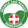
We have 3 hi-spec drones equipped with video and thermal imaging technology, allowing us to search / survey large areas quickly. The thermal imaging camera allows us to locate missing persons at night, or in hard to reach terrain for example. Once located, their position can be transmitted to the Foot search teams to expedite their recovery. The drone can also be flown overhead using its 26w spotlight to light up an area to assist the foot teams in a search or recovery.
The Drone Team...
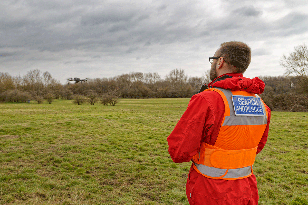
Our drone teams consist of two operatives, a pilot and a spotter…
- The pilot is responsible for the safe operation of the drone, and the navigation to, and over the search area, whilst monitoring the inflight parameters including battery level, distance and altitude. All Whilst also monitoring the thermal / video feed in the search for the missing person.
Pilots must be qualified as commercial drone pilots via the A2 CofC (or similar approved) which is a Civil Aviation Authority (CAA) qualification to operate drones in the Open Category - The spotter is a crucial safety measure to monitor the visual line of sight to the drone at all times. This is to ensure the public are at a safe distance, collision avoidance with trees, buildings and pylons etc, and to monitor any other air traffic in the area. The spotter is also required to maintain radio contact with control, to report the start and end of each search flight, and report any significant finds.
This two man operation may be seen as a comparable scenario to a 2 pilot operation on commercial aircraft. As such we always run through a preflight checklist before every operation. Additionally clearance from the relative authorities / land owner will always be sought when required or appropriate.
 |
 |
The Drone...
The drone is GPS enabled and is able to sense its location, distance from the pilot and its altitude, it has a flight time of around 24-30 minutes per battery, and has a maximum speed of 44mph. It has inbuilt collision avoidance and will automatically return to home (take off point) and land when it senses its battery is low. Due to its GPS capabilities it can only fly in unrestricted airspace, and will therefore not operate in and around civilian / commercial airports or other security restricted areas, which are protected by a Geofence system, pre-programmed into every Drone, where it simply will not 'take-off' close to, or fly over.
As we rely on the drone as our eyes in the sky, the feed from the gimbal stabilised camera array gives us thermal imaging capabilities, as well as hi-res video and still photography options. It can zoom to 16x in thermal imaging mode, and 32x in video / photo mode. These images can also be live streamed to our Incident Control Unit (ICU) allowing the operations team to see exactly what we see, no matter of their location.
At least one drone is carried to each incident, allowing us to deploy the drone within minutes if needed. The thermal imaging capabilities are particularly useful at night sensing the heat signature of a person on the ground.
 |
 |
|
| Drone camera view of pilot and spotter | Thermal image view of pilot and spotter |
Sadly, Lowland Rescue does not enjoy the fame of the RNLI, and as such we have to work very hard just to raise the funds we need to exist. Hopefully these articles will help raise our profile just enough, so that we continue to receive adequate funding for the future. You can help here.